Mapping sea-level change
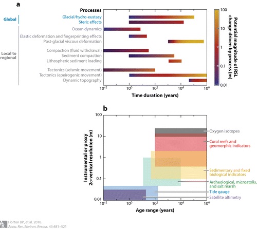
Members of PAGES' PALSEA working group review the current methodologies and data sources used to reconstruct the history of sea-level change over geological (Pliocene, Last Interglacial, and Holocene) and instrumental (tide-gauge and satellite alimetry) eras, and the tools used to project the future spatial and temporal evolution of sea level, in a recent Annual Review of Environment and Resources paper.
Led by Benjamin Horton, authors use case studies from Singapore and New Jersey to illustrate the ways in which current methodologies and data sources can constrain future projections, and how accurate projections can motivate the development of new sea-level research questions across relevant timescales.
Access "Mapping Sea-Level Change in Time, Space, and Probability" here.